
Huka Falls
- Distance: 0.8 mi
- Elevation gain: 151 ft
- Maximum elevation: 1,230 ft
- Elevation loss: 138 ft
- Minimum elevation: 1,138 ft
- Moving time: 20 m 27 s
- Moving speed: 2.4 mph
- Maximum speed: 4.3 mph
- Total time: 33 m 4 s
- Global speed: 1.5 mph
Interactive trail map
Trail profile
- Distance: 0.8 mi
- Elevation gain: 151 ft
- Maximum elevation: 1,230 ft
- Elevation loss: 138 ft
- Minimum elevation: 1,138 ft
- Moving time: 20 m 27 s
- Moving speed: 2.4 mph
- Maximum speed: 4.3 mph
- Total time: 33 m 4 s
- Global speed: 1.5 mph
About this trail
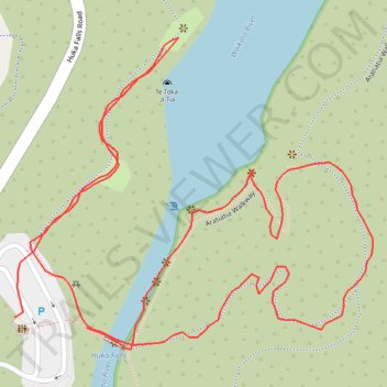
Name: Huka Falls trail, distance, elevation, map, profile, GPS track
Start: Aratiatia Walkway, Taupō District, Waikato, 3332, New Zealand (-38.64955 176.08919)
Coordinates: -38.64969 176.08859 -38.64766 176.09158