
2026-10-28_10-33_Wed
- Distance: 1.5 mi
- Elevation gain: 33 ft
- Maximum elevation: 1,060 ft
- Elevation loss: 30 ft
- Minimum elevation: 1,037 ft
Interactive trail map
Trail profile
- Distance: 1.5 mi
- Elevation gain: 33 ft
- Maximum elevation: 1,060 ft
- Elevation loss: 30 ft
- Minimum elevation: 1,037 ft
About this trail
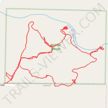
Name: 2026-10-28_10-33_Wed trail, distance, elevation, map, profile, GPS track
Coordinates: 42.60378 -91.63785 42.60617 -91.63282
Topography: Buchanan County topographic map, elevation, terrain