Ballater
Mountain Bike Ride #UK #Aberdeenshire #Ballater
- Distance: 5.9 mi
- Elevation gain: 141 ft
- Maximum elevation: 669 ft
- Elevation loss: 141 ft
- Minimum elevation: 620 ft
- Moving time: 1 h 6 m
- Moving speed: 5.3 mph
- Maximum speed: 14.4 mph
- Total time: 1 h 13 m
- Global speed: 4.8 mph
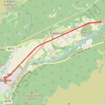
Interactive trail map
Trail profile
- Distance: 5.9 mi
- Elevation gain: 141 ft
- Maximum elevation: 669 ft
- Elevation loss: 141 ft
- Minimum elevation: 620 ft
- Moving time: 1 h 6 m
- Moving speed: 5.3 mph
- Maximum speed: 14.4 mph
- Total time: 1 h 13 m
- Global speed: 4.8 mph
About this trail
Name: Ballater trail, distance, elevation, map, profile, GPS track
Start: Church Square, Ballater, Aberdeenshire, Scotland, AB35 5QQ, United Kingdom (57.04835 -3.04021)
End: Church Square, Ballater, Aberdeenshire, Scotland, AB35 5QQ, United Kingdom (57.04842 -3.04031)
Coordinates: 57.04835 -3.04150 57.06899 -2.98259
Other hiking, mountain biking, running and outdoor activity trails
Click on a trail to view its statistics, map and profile.
Ride along the River Dee
United Kingdom > Scotland > Aberdeen City
Distance: 62.8 mi • Elevation gain: 4,003 ft • Maximum elevation: 1,217 ft