Devon walk
- Distance: 3.0 mi
- Elevation gain: 272 ft
- Maximum elevation: 899 ft
- Elevation loss: 217 ft
- Minimum elevation: 676 ft
- Moving time: 54 m 42 s
- Moving speed: 3.3 mph
- Maximum speed: 7.5 mph
- Total time: 1 h 1 m
- Global speed: 2.9 mph
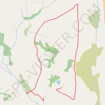
Interactive trail map
Trail profile
- Distance: 3.0 mi
- Elevation gain: 272 ft
- Maximum elevation: 899 ft
- Elevation loss: 217 ft
- Minimum elevation: 676 ft
- Moving time: 54 m 42 s
- Moving speed: 3.3 mph
- Maximum speed: 7.5 mph
- Total time: 1 h 1 m
- Global speed: 2.9 mph
About this trail
Name: Devon walk trail, distance, elevation, map, profile, GPS track
Start: South Tawton, Throwleigh, West Devon, Devon, England, EX20 2JQ, United Kingdom (50.69919 -3.86936)
End: South Tawton, Throwleigh, West Devon, Devon, England, EX20 2JQ, United Kingdom (50.70079 -3.86498)
Coordinates: 50.69863 -3.87367 50.71383 -3.86076