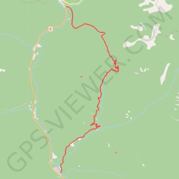
Huckleberry Pass
- Distance: 14.8 mi
- Elevation gain: 2,953 ft
- Maximum elevation: 4,859 ft
- Elevation loss: 2,306 ft
- Minimum elevation: 2,379 ft
- Moving time: 42 m 34 s
- Moving speed: 20.9 mph
- Maximum speed: 43.7 mph
- Total time: 1 h 2 m
- Global speed: 14.2 mph
Interactive trail map
Trail profile
- Distance: 14.8 mi
- Elevation gain: 2,953 ft
- Maximum elevation: 4,859 ft
- Elevation loss: 2,306 ft
- Minimum elevation: 2,379 ft
- Moving time: 42 m 34 s
- Moving speed: 20.9 mph
- Maximum speed: 43.7 mph
- Total time: 1 h 2 m
- Global speed: 14.2 mph
About this trail
Name: Huckleberry Pass trail, distance, elevation, map, profile, GPS track
Coordinates: 49.28161 -117.21312 49.40480 -117.14687
Other hiking, mountain biking, running and outdoor activity trails
Click on a trail to view its statistics, map and profile.
Castlegar - Crawford Bay
Canada > British Columbia > Regional District of Central Kootenay > Area J (Lower Arrow/Columbia) > Raspberry
Kootenay River. #Bike
Distance: 56.6 mi • Elevation gain: 3,917 ft • Maximum elevation: 2,277 ft
Porcupine
Canada > British Columbia > Regional District of Central Kootenay > Nelson
Distance: 37.6 mi • Elevation gain: 6,391 ft • Maximum elevation: 5,781 ft