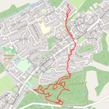
West Berkshire Walking
- Distance: 3.2 mi
- Elevation gain: 82 ft
- Maximum elevation: 318 ft
- Elevation loss: 72 ft
- Minimum elevation: 266 ft
- Moving time: 1 h 20 m
- Moving speed: 2.4 mph
- Maximum speed: 5.3 mph
- Total time: 1 h 28 m
- Global speed: 2.2 mph
Interactive trail map
Trail profile
- Distance: 3.2 mi
- Elevation gain: 82 ft
- Maximum elevation: 318 ft
- Elevation loss: 72 ft
- Minimum elevation: 266 ft
- Moving time: 1 h 20 m
- Moving speed: 2.4 mph
- Maximum speed: 5.3 mph
- Total time: 1 h 28 m
- Global speed: 2.2 mph
About this trail
Name: West Berkshire Walking trail, distance, elevation, map, profile, GPS track
Coordinates: 51.39111 -1.06482 51.40307 -1.05676