Make a donation
Gear up for your next adventure:
As an Amazon Associate, this site earns from qualifying purchases at no extra cost to you.
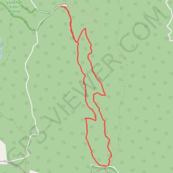
Tanglefoot Loop
Interactive trail map
Make a donation
Gear up for your next adventure:
As an Amazon Associate, this site earns from qualifying purchases at no extra cost to you.
Trail profile
- Distance: 5.5 mi
- Elevation gain: 1,109 ft
- Maximum elevation: 3,035 ft
- Elevation loss: 1,145 ft
- Minimum elevation: 2,064 ft
- Moving time: 1 h 58 m
- Moving speed: 2.8 mph
- Maximum speed: 9.4 mph
- Total time: 2 h 3 m
- Global speed: 2.7 mph
Make a donation
Gear up for your next adventure:
As an Amazon Associate, this site earns from qualifying purchases at no extra cost to you.
About this trail
Name: Tanglefoot Loop trail, distance, elevation, map, profile, GPS track
Start: Tanglefoot Loop, Toolangi, Shire of Murrindindi, Victoria, 3777, Australia (-37.52776 145.52202)
End: Wirrawilla Road, Toolangi, Shire of Murrindindi, Victoria, 3777, Australia (-37.52752 145.52124)
Coordinates: -37.55688 145.52124 -37.52750 145.53282
Make a donation
Gear up for your next adventure:
As an Amazon Associate, this site earns from qualifying purchases at no extra cost to you.
Other hiking, mountain biking, running and outdoor activity trails
Click on a trail to view its statistics, map and profile.
Tallarook - Eildon - Hurstbridge
Australia > Victoria > Tallarook
#Bike
Distance: 173.2 mi • Elevation gain: 16,066 ft • Maximum elevation: 2,848 ft
Tanglefoot Trails of Toolangi
Distance: 9.7 mi • Elevation gain: 1,903 ft • Maximum elevation: 3,035 ft