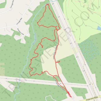
Stone Bridge Loop Trail
- Distance: 2.7 mi
- Elevation gain: 75 ft
- Maximum elevation: 200 ft
- Elevation loss: 75 ft
- Minimum elevation: 167 ft
- Moving time: 56 m 50 s
- Moving speed: 2.8 mph
- Maximum speed: 8.7 mph
- Total time: 1 h 10 m
- Global speed: 2.3 mph
Interactive trail map
Trail profile
- Distance: 2.7 mi
- Elevation gain: 75 ft
- Maximum elevation: 200 ft
- Elevation loss: 75 ft
- Minimum elevation: 167 ft
- Moving time: 56 m 50 s
- Moving speed: 2.8 mph
- Maximum speed: 8.7 mph
- Total time: 1 h 10 m
- Global speed: 2.3 mph
About this trail
Name: Stone Bridge Loop Trail trail, distance, elevation, map, profile, GPS track
Coordinates: 40.20430 -74.37358 40.21448 -74.36761
Topography: Monmouth County topographic map, elevation, terrain