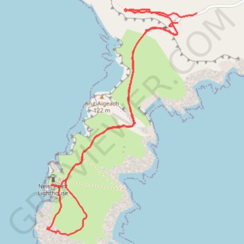
Neist Point Walk
- Distance: 2.2 mi
- Elevation gain: 492 ft
- Maximum elevation: 308 ft
- Elevation loss: 482 ft
- Minimum elevation: 13 ft
- Moving time: 59 m 47 s
- Moving speed: 2.3 mph
- Maximum speed: 10.9 mph
- Total time: 1 h 32 m
- Global speed: 1.5 mph
Interactive trail map
Trail profile
- Distance: 2.2 mi
- Elevation gain: 492 ft
- Maximum elevation: 308 ft
- Elevation loss: 482 ft
- Minimum elevation: 13 ft
- Moving time: 59 m 47 s
- Moving speed: 2.3 mph
- Maximum speed: 10.9 mph
- Total time: 1 h 32 m
- Global speed: 1.5 mph
About this trail
Name: Neist Point Walk trail, distance, elevation, map, profile, GPS track
Coordinates: 57.42113 -6.78866 57.43015 -6.77757