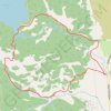
Bradley Lake and Taggart Lake Loop Trail in Grand Teton National Park
This loop hike to Bradley and Taggart lakes offers a fantastic blend of tranquil lakes and gorgeous views of the Tetons. With well-maintained paths and gentle elevation, it’s a great hike for those looking to enjoy a peaceful day outdoors. #Hiking #Mountain #Lake #Forest #Nature
- Distance: 6.0 mi
- Elevation gain: 689 ft
- Maximum elevation: 7,162 ft
- Elevation loss: 689 ft
- Minimum elevation: 6,624 ft
- Moving time: 1 h 58 m
- Moving speed: 3.0 mph
- Maximum speed: 5.3 mph
- Total time: 2 h 20 m
- Global speed: 2.6 mph
Interactive trail map
Trail profile
- Distance: 6.0 mi
- Elevation gain: 689 ft
- Maximum elevation: 7,162 ft
- Elevation loss: 689 ft
- Minimum elevation: 6,624 ft
- Moving time: 1 h 58 m
- Moving speed: 3.0 mph
- Maximum speed: 5.3 mph
- Total time: 2 h 20 m
- Global speed: 2.6 mph
About this trail
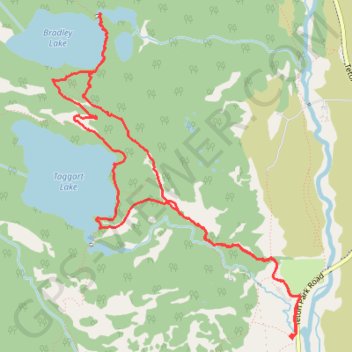
Name: Bradley Lake and Taggart Lake Loop Trail in Grand Teton National Park trail, distance, elevation, map, profile, GPS track
Coordinates: 43.69298 -110.75621 43.71596 -110.73205
Topography: Teton County topographic map, elevation, terrain
Other hiking, mountain biking, running and outdoor activity trails
Click on a trail to view its statistics, map and profile.
Taggart Lake Loop Trail in Grand Teton National Park
United States > Wyoming > Teton County > Beaver Creek
The Taggart Lake Loop is a perfect mix of easy hiking and incredible mountain views. As you make your way through forests and open meadows, you'll be rewarded with a peaceful lakeside scene, where the Tetons reflect beautifully on the water. It's a family-friendly trail, offering just enough adventure without…
Distance: 3.8 mi • Elevation gain: 433 ft • Maximum elevation: 6,995 ft