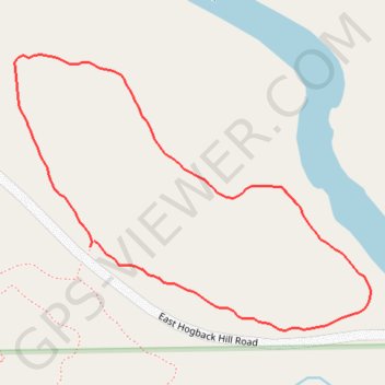
Big Pine Creek Trail
Lunch Walk
- Distance: 0.7 mi
- Elevation gain: 62 ft
- Maximum elevation: 650 ft
- Elevation loss: 62 ft
- Minimum elevation: 584 ft
- Moving time: 13 m 59 s
- Moving speed: 2.8 mph
- Maximum speed: 3.7 mph
- Total time: 13 m 59 s
- Global speed: 2.8 mph
Interactive trail map
Trail profile
- Distance: 0.7 mi
- Elevation gain: 62 ft
- Maximum elevation: 650 ft
- Elevation loss: 62 ft
- Minimum elevation: 584 ft
- Moving time: 13 m 59 s
- Moving speed: 2.8 mph
- Maximum speed: 3.7 mph
- Total time: 13 m 59 s
- Global speed: 2.8 mph
About this trail
Name: Big Pine Creek Trail trail, distance, elevation, map, profile, GPS track
Start: Big Pine Creek Trail, Warren County, Indiana, United States (40.34083 -87.31864)
End: Big Pine Creek Trail, Warren County, Indiana, United States (40.34077 -87.31870)
Coordinates: 40.33999 -87.31963 40.34258 -87.31524
Topography: Warren County topographic map, elevation, terrain