Make a donation
Gear up for your next adventure:
As an Amazon Associate, this site earns from qualifying purchases at no extra cost to you.
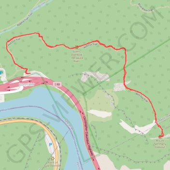
Mount Tammany and Delaware River Overlook via Red Dot Trail in Worthington State Forest
Hiking the Red Dot Trail offers an invigorating experience with stunning views of the Delaware River and the surrounding Kittatinny Mountains. As you ascend, you'll encounter rocky sections that provide rewarding overlooks, especially during the fall when the foliage is vibrant. This route not only highlights the natural beauty of the area but also provides various overlooks perfect for photography and reflection, making it a memorable hike for all who venture there. #Hiking #Mountain #River #Overlook #Forest #Nature
- Distance: 2.5 mi
- Elevation gain: 1,129 ft
- Maximum elevation: 1,434 ft
- Elevation loss: 1,125 ft
- Minimum elevation: 351 ft
- Moving time: 1 h 27 m
- Moving speed: 1.7 mph
- Maximum speed: 6.6 mph
- Total time: 1 h 46 m
- Global speed: 1.4 mph
Interactive trail map
Make a donation
Gear up for your next adventure:
As an Amazon Associate, this site earns from qualifying purchases at no extra cost to you.
Trail profile
- Distance: 2.5 mi
- Elevation gain: 1,129 ft
- Maximum elevation: 1,434 ft
- Elevation loss: 1,125 ft
- Minimum elevation: 351 ft
- Moving time: 1 h 27 m
- Moving speed: 1.7 mph
- Maximum speed: 6.6 mph
- Total time: 1 h 46 m
- Global speed: 1.4 mph
Make a donation
Gear up for your next adventure:
As an Amazon Associate, this site earns from qualifying purchases at no extra cost to you.
About this trail
Name: Mount Tammany and Delaware River Overlook via Red Dot Trail in Worthington State Forest trail, distance, elevation, map, profile, GPS track
Coordinates: 40.96803 -75.12537 40.97428 -75.11286
Topography: Warren County topographic map, elevation, terrain
Make a donation
Gear up for your next adventure:
As an Amazon Associate, this site earns from qualifying purchases at no extra cost to you.
Other hiking, mountain biking, running and outdoor activity trails
Click on a trail to view its statistics, map and profile.
Mount Tammany Loop via Red Dot Trail, Delaware River Overlook and Blue Blaze in Worthington State Forest
United States > New Jersey > Warren County > Hardwick Township > Dunnfield
The Mount Tammany Loop offers a captivating hiking experience with its stunning panoramic views of the Delaware River and the surrounding landscapes. The ascent via the Red Dot Trail features rocky terrain and steep inclines, rewarding hikers with scenic overlooks, particularly the dramatic vistas of Mount…
Distance: 3.5 mi • Elevation gain: 1,198 ft • Maximum elevation: 1,503 ft