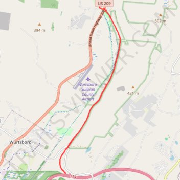
Wutsboro Ridge State Forest Upper O&W Rail Trail
- Distance: 9.6 mi
- Elevation gain: 502 ft
- Maximum elevation: 837 ft
- Elevation loss: 505 ft
- Minimum elevation: 525 ft
- Moving time: 2 h 35 m
- Moving speed: 3.7 mph
- Maximum speed: 10.6 mph
- Total time: 6 h 5 m
- Global speed: 1.6 mph
Interactive trail map
Trail profile
- Distance: 9.6 mi
- Elevation gain: 502 ft
- Maximum elevation: 837 ft
- Elevation loss: 505 ft
- Minimum elevation: 525 ft
- Moving time: 2 h 35 m
- Moving speed: 3.7 mph
- Maximum speed: 10.6 mph
- Total time: 6 h 5 m
- Global speed: 1.6 mph
About this trail
Name: Wutsboro Ridge State Forest Upper O&W Rail Trail trail, distance, elevation, map, profile, GPS track
Coordinates: 41.56663 -74.47008 41.62033 -74.44398
Topography: Sullivan County topographic map, elevation, terrain