Arch Rock Loop via Glen Trail, Coast Trail and Bear Valley Trail
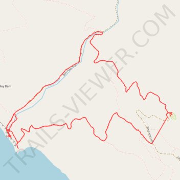
Starting from Glen Campground, this loop leaves the quiet backcountry camp area on the Glen Trail, crossing wooded ridges, small drainages, coastal scrub and open grassy slopes before bending westward toward the exposed Pacific side of Point Reyes National Seashore.
The route then follows the Coast Trail toward the Miller Point and former Arch Rock area, where the sheltered inland landscape gives way to ocean bluffs, sea stacks, surf-facing headlands and broad views over the wild shoreline.
After exploring the coastal edge, the loop turns inland on the Bear Valley Trail, tracing a gentler valley corridor with creekside vegetation, forest shade and meadow openings before climbing back through the Glen Trail network to the campground.
#Hiking #Loop #Coast #Rock #Pacific #Ocean #Bluffs #Cliffs #Forest #Meadow #Creek #Backcountry #California #Nature #Trail #Adventure #Sea
- Distance: 5.9 mi
- Elevation gain: 1,138 ft
- Maximum elevation: 804 ft
- Elevation loss: 1,142 ft
- Minimum elevation: 7 ft
- Moving time: 2 h 42 m
- Moving speed: 2.2 mph
- Maximum speed: 6.8 mph
- Total time: 3 h 7 m
- Global speed: 1.9 mph
Interactive trail map
Trail profile
- Distance: 5.9 mi
- Elevation gain: 1,138 ft
- Maximum elevation: 804 ft
- Elevation loss: 1,142 ft
- Minimum elevation: 7 ft
- Moving time: 2 h 42 m
- Moving speed: 2.2 mph
- Maximum speed: 6.8 mph
- Total time: 3 h 7 m
- Global speed: 1.9 mph
About this trail
Name: Arch Rock Loop via Glen Trail, Coast Trail and Bear Valley Trail trail, distance, elevation, map, profile, GPS track
Start: 11, Glen Camp Loop, Marin County, California, United States (37.98927 -122.78858)
End: 10, Glen Camp Loop, Marin County, California, United States (37.98942 -122.78826)
Coordinates: 37.98538 -122.81347 37.99941 -122.78809
Topography: Marin County topographic map, elevation, terrain
Other hiking, mountain biking, running and outdoor activity trails
Click on a trail to view its statistics, map and profile.
Point Reyes National Seashore
United States > California > Marin County > Blakes Landing
Point Reyes, Route 1 to Lighthouse
Distance: 32.2 mi • Elevation gain: 2,694 ft • Maximum elevation: 505 ft
Point Reyes Loop
United States > California > Marin County > Mill Valley
Distance: 62.3 mi • Elevation gain: 6,234 ft • Maximum elevation: 774 ft