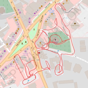
Esher wander
- Distance: 1.1 mi
- Elevation gain: 49 ft
- Maximum elevation: 151 ft
- Elevation loss: 23 ft
- Minimum elevation: 118 ft
- Moving time: 22 m 30 s
- Moving speed: 2.9 mph
- Maximum speed: 4.6 mph
- Total time: 23 m 11 s
- Global speed: 2.8 mph
Interactive trail map
Trail profile
- Distance: 1.1 mi
- Elevation gain: 49 ft
- Maximum elevation: 151 ft
- Elevation loss: 23 ft
- Minimum elevation: 118 ft
- Moving time: 22 m 30 s
- Moving speed: 2.9 mph
- Maximum speed: 4.6 mph
- Total time: 23 m 11 s
- Global speed: 2.8 mph
About this trail
Name: Esher wander trail, distance, elevation, map, profile, GPS track
Coordinates: 51.36806 -0.36620 51.37019 -0.36364