Binduyan Falls
- Distance: 0.2 mi
- Elevation gain: 20 ft
- Maximum elevation: 39 ft
- Elevation loss: 7 ft
- Minimum elevation: 16 ft
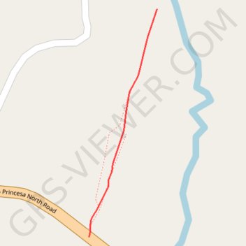
Interactive trail map
Trail profile
- Distance: 0.2 mi
- Elevation gain: 20 ft
- Maximum elevation: 39 ft
- Elevation loss: 7 ft
- Minimum elevation: 16 ft
About this trail
Name: Binduyan Falls trail, distance, elevation, map, profile, GPS track
Start: Puerto Princesa North Road, Puerto Princesa, Mimaropa, Philippines (10.01026 119.04788)
End: Puerto Princesa, Mimaropa, Philippines (10.01244 119.04854)
Coordinates: 10.01026 119.04788 10.01244 119.04854