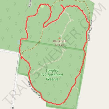
Black Hill Loop Trail, Kyneton
- Distance: 2.8 mi
- Elevation gain: 295 ft
- Maximum elevation: 1,867 ft
- Elevation loss: 292 ft
- Minimum elevation: 1,713 ft
- Moving time: 1 h 25 m
- Moving speed: 2.0 mph
- Maximum speed: 4.6 mph
- Total time: 1 h 50 m
- Global speed: 1.5 mph
Interactive trail map
Trail profile
- Distance: 2.8 mi
- Elevation gain: 295 ft
- Maximum elevation: 1,867 ft
- Elevation loss: 292 ft
- Minimum elevation: 1,713 ft
- Moving time: 1 h 25 m
- Moving speed: 2.0 mph
- Maximum speed: 4.6 mph
- Total time: 1 h 50 m
- Global speed: 1.5 mph
About this trail
Name: Black Hill Loop Trail, Kyneton trail, distance, elevation, map, profile, GPS track
Coordinates: -37.19164 144.48347 -37.18037 144.49326