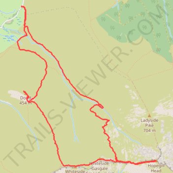
Dodd, Whiteside East Top, Gasgale Crags Summit and Hopegill Head Loop Hike
- Distance: 5.4 mi
- Elevation gain: 2,129 ft
- Maximum elevation: 2,454 ft
- Elevation loss: 2,142 ft
- Minimum elevation: 581 ft
- Moving time: 2 h 49 m
- Moving speed: 1.9 mph
- Maximum speed: 8.3 mph
- Total time: 5 h 22 m
- Global speed: 1.0 mph
Interactive trail map
Trail profile
- Distance: 5.4 mi
- Elevation gain: 2,129 ft
- Maximum elevation: 2,454 ft
- Elevation loss: 2,142 ft
- Minimum elevation: 581 ft
- Moving time: 2 h 49 m
- Moving speed: 1.9 mph
- Maximum speed: 8.3 mph
- Total time: 5 h 22 m
- Global speed: 1.0 mph
About this trail
Name: Dodd, Whiteside East Top, Gasgale Crags Summit and Hopegill Head Loop Hike trail, distance, elevation, map, profile, GPS track
Start: B5292, High Lorton, Lorton, Cumberland, England, CA13 9UA, United Kingdom (54.60582 -3.28824)
End: Lorton, Cumberland, England, CA13 9UD, United Kingdom (54.60578 -3.28849)
Coordinates: 54.58738 -3.28942 54.60587 -3.26171