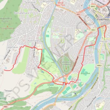
Across Inverness by Bike
- Distance: 3.8 mi
- Elevation gain: 305 ft
- Maximum elevation: 292 ft
- Elevation loss: 85 ft
- Minimum elevation: 16 ft
- Moving time: 28 m 1 s
- Moving speed: 8.1 mph
- Maximum speed: 26.3 mph
- Total time: 28 m 1 s
- Global speed: 8.1 mph
Interactive trail map
Trail profile
- Distance: 3.8 mi
- Elevation gain: 305 ft
- Maximum elevation: 292 ft
- Elevation loss: 85 ft
- Minimum elevation: 16 ft
- Moving time: 28 m 1 s
- Moving speed: 8.1 mph
- Maximum speed: 26.3 mph
- Total time: 28 m 1 s
- Global speed: 8.1 mph
About this trail
Name: Across Inverness by Bike trail, distance, elevation, map, profile, GPS track
Coordinates: 57.46275 -4.27129 57.47757 -4.22441
Other hiking, mountain biking, running and outdoor activity trails
Click on a trail to view its statistics, map and profile.
General Wade's Military Road
United Kingdom > Scotland > Highland > Invermoriston
Distance: 53.7 mi • Elevation gain: 3,940 ft • Maximum elevation: 1,286 ft