Air Line State Park Trail and Tri-State Marker Loop Trail
- Distance: 1.9 mi
- Elevation gain: 203 ft
- Maximum elevation: 607 ft
- Elevation loss: 203 ft
- Minimum elevation: 469 ft
- Moving time: 1 h 4 m
- Moving speed: 1.8 mph
- Maximum speed: 3.8 mph
- Total time: 1 h 17 m
- Global speed: 1.5 mph
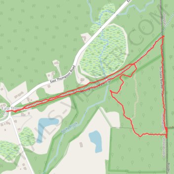
Interactive trail map
Trail profile
- Distance: 1.9 mi
- Elevation gain: 203 ft
- Maximum elevation: 607 ft
- Elevation loss: 203 ft
- Minimum elevation: 469 ft
- Moving time: 1 h 4 m
- Moving speed: 1.8 mph
- Maximum speed: 3.8 mph
- Total time: 1 h 17 m
- Global speed: 1.5 mph
About this trail
Name: Air Line State Park Trail and Tri-State Marker Loop Trail trail, distance, elevation, map, profile, GPS track
Coordinates: 42.00758 -71.80929 42.01236 -71.79915
Topography: Northeastern Connecticut Planning Region topographic map, elevation, terrain