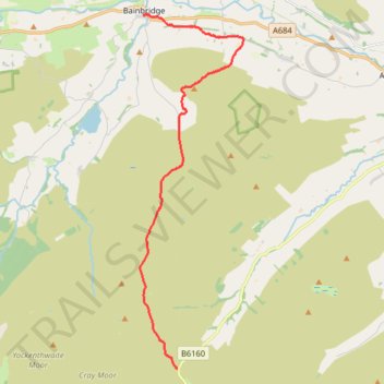
Hike from Kirkstone Pass to Bainbridge via Addlebrough
- Distance: 9.0 mi
- Elevation gain: 879 ft
- Maximum elevation: 1,841 ft
- Elevation loss: 1,532 ft
- Minimum elevation: 715 ft
- Moving time: 3 h 41 m
- Moving speed: 2.4 mph
- Maximum speed: 4.3 mph
- Total time: 4 h 14 m
- Global speed: 2.1 mph
Interactive trail map
Trail profile
- Distance: 9.0 mi
- Elevation gain: 879 ft
- Maximum elevation: 1,841 ft
- Elevation loss: 1,532 ft
- Minimum elevation: 715 ft
- Moving time: 3 h 41 m
- Moving speed: 2.4 mph
- Maximum speed: 4.3 mph
- Total time: 4 h 14 m
- Global speed: 2.1 mph
About this trail
Name: Hike from Kirkstone Pass to Bainbridge via Addlebrough trail, distance, elevation, map, profile, GPS track
Coordinates: 54.21927 -2.10469 54.30658 -2.06097