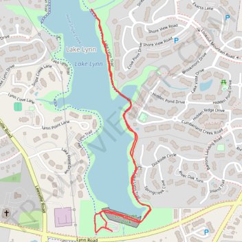
Section of Lake Lynn Trail
- Distance: 1.8 mi
- Elevation gain: 89 ft
- Maximum elevation: 371 ft
- Elevation loss: 92 ft
- Minimum elevation: 328 ft
- Moving time: 42 m 25 s
- Moving speed: 2.6 mph
- Maximum speed: 3.6 mph
- Total time: 49 m 3 s
- Global speed: 2.2 mph
Interactive trail map
Trail profile
- Distance: 1.8 mi
- Elevation gain: 89 ft
- Maximum elevation: 371 ft
- Elevation loss: 92 ft
- Minimum elevation: 328 ft
- Moving time: 42 m 25 s
- Moving speed: 2.6 mph
- Maximum speed: 3.6 mph
- Total time: 49 m 3 s
- Global speed: 2.2 mph
About this trail
Name: Section of Lake Lynn Trail trail, distance, elevation, map, profile, GPS track
Coordinates: 35.87204 -78.69863 35.88110 -78.69567
Topography: Raleigh topographic map, elevation, terrain