Batsford Arboretum
- Distance: 5.0 mi
- Elevation gain: 659 ft
- Maximum elevation: 801 ft
- Elevation loss: 633 ft
- Minimum elevation: 577 ft
- Moving time: 1 h 56 m
- Moving speed: 2.6 mph
- Maximum speed: 9.1 mph
- Total time: 2 h 33 m
- Global speed: 2.0 mph
Interactive trail map
Trail profile
- Distance: 5.0 mi
- Elevation gain: 659 ft
- Maximum elevation: 801 ft
- Elevation loss: 633 ft
- Minimum elevation: 577 ft
- Moving time: 1 h 56 m
- Moving speed: 2.6 mph
- Maximum speed: 9.1 mph
- Total time: 2 h 33 m
- Global speed: 2.0 mph
About this trail
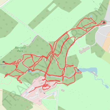
Name: Batsford Arboretum trail, distance, elevation, map, profile, GPS track
Coordinates: 51.99829 -1.74039 52.00352 -1.72889