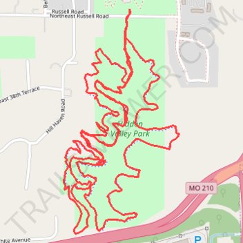
Hidden Valley Park
- Distance: 6.7 mi
- Elevation gain: 476 ft
- Maximum elevation: 879 ft
- Elevation loss: 479 ft
- Minimum elevation: 791 ft
- Moving time: 1 h 59 m
- Moving speed: 3.4 mph
- Maximum speed: 7.9 mph
- Total time: 2 h 2 m
- Global speed: 3.3 mph
Interactive trail map
Trail profile
- Distance: 6.7 mi
- Elevation gain: 476 ft
- Maximum elevation: 879 ft
- Elevation loss: 479 ft
- Minimum elevation: 791 ft
- Moving time: 1 h 59 m
- Moving speed: 3.4 mph
- Maximum speed: 7.9 mph
- Total time: 2 h 2 m
- Global speed: 3.3 mph
About this trail
Name: Hidden Valley Park trail, distance, elevation, map, profile, GPS track
Coordinates: 39.15539 -94.50963 39.16644 -94.50230
Topography: Kansas City topographic map, elevation, terrain