Crescent Rock Vista via Appalachian Trail
The Crescent Rock Vista hike along the Appalachian Trail offers a serene journey through dense forest, culminating in breathtaking panoramic views of the Shenandoah Valley, including the rolling Massanutten Mountain range. As you make your way along the trail, you’ll pass through peaceful woodlands of hemlock and spruce, with moments of quiet seclusion that make the experience feel like a peaceful retreat. Upon reaching the overlook, visitors are rewarded with a striking vista where the valley unfolds below, framed by the enduring beauty of the Blue Ridge Mountains. #Hiking #Mountain #Forest #Nature #Overlook
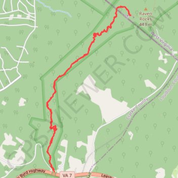
- Distance: 5.5 mi
- Elevation gain: 1,417 ft
- Maximum elevation: 1,227 ft
- Elevation loss: 1,414 ft
- Minimum elevation: 856 ft
- Moving time: 2 h 2 m
- Moving speed: 2.7 mph
- Maximum speed: 5.5 mph
- Total time: 2 h 34 m
- Global speed: 2.1 mph
Interactive trail map
Trail profile
- Distance: 5.5 mi
- Elevation gain: 1,417 ft
- Maximum elevation: 1,227 ft
- Elevation loss: 1,414 ft
- Minimum elevation: 856 ft
- Moving time: 2 h 2 m
- Moving speed: 2.7 mph
- Maximum speed: 5.5 mph
- Total time: 2 h 34 m
- Global speed: 2.1 mph
About this trail
Name: Crescent Rock Vista via Appalachian Trail trail, distance, elevation, map, profile, GPS track
Start: Pine Grove Road, Clarke County, Virginia, 20135, United States (39.11665 -77.85240)
End: Pine Grove Road, Clarke County, Virginia, 20135, United States (39.11637 -77.85203)
Coordinates: 39.11637 -77.85354 39.14051 -77.83764
Topography: Clarke County topographic map, elevation, terrain
Other hiking, mountain biking, running and outdoor activity trails
Click on a trail to view its statistics, map and profile.
Raven Rocks via Appalachian Trail
United States > Virginia > Clarke County > Keys Gap
Hiking the Raven Rocks offers a rewarding mix of challenge and stunning scenery. The rocky terrain demands careful footing, especially on descents and ascents, making it a workout for even seasoned hikers. Upon reaching the overlook, you’re treated to breathtaking views of the Shenandoah Valley and distant…
Distance: 5.0 mi • Elevation gain: 1,339 ft • Maximum elevation: 1,224 ft