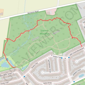
Stamm Woodlot
- Distance: 1.0 mi
- Elevation gain: 59 ft
- Maximum elevation: 1,207 ft
- Elevation loss: 49 ft
- Minimum elevation: 1,171 ft
- Moving time: 33 m 27 s
- Moving speed: 1.9 mph
- Maximum speed: 6.0 mph
- Total time: 39 m 24 s
- Global speed: 1.6 mph
Interactive trail map
Trail profile
- Distance: 1.0 mi
- Elevation gain: 59 ft
- Maximum elevation: 1,207 ft
- Elevation loss: 49 ft
- Minimum elevation: 1,171 ft
- Moving time: 33 m 27 s
- Moving speed: 1.9 mph
- Maximum speed: 6.0 mph
- Total time: 39 m 24 s
- Global speed: 1.6 mph
About this trail
Name: Stamm Woodlot trail, distance, elevation, map, profile, GPS track
Coordinates: 43.49163 -80.58968 43.49612 -80.57996