Adelmann Mine in Boise Front Area of Critical Environmental Concern
The Adelmann Mine trail offers a captivating hike through diverse landscapes, including forests and open meadows. As you approach the historic gold mine, you'll encounter remnants of mining operations along with scenic views of the surrounding mountains and Boise River, making it a rewarding experience for those interested in history and nature alike. #Hiking #Mountain #Forest #Nature
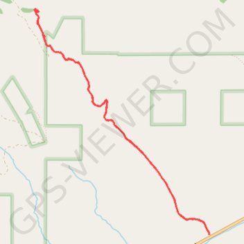
- Distance: 4.8 mi
- Elevation gain: 1,398 ft
- Maximum elevation: 4,957 ft
- Elevation loss: 1,398 ft
- Minimum elevation: 3,629 ft
- Moving time: 1 h 58 m
- Moving speed: 2.4 mph
- Maximum speed: 6.6 mph
- Total time: 2 h 11 m
- Global speed: 2.2 mph
Interactive trail map
Trail profile
- Distance: 4.8 mi
- Elevation gain: 1,398 ft
- Maximum elevation: 4,957 ft
- Elevation loss: 1,398 ft
- Minimum elevation: 3,629 ft
- Moving time: 1 h 58 m
- Moving speed: 2.4 mph
- Maximum speed: 6.6 mph
- Total time: 2 h 11 m
- Global speed: 2.2 mph
About this trail
Name: Adelmann Mine in Boise Front Area of Critical Environmental Concern trail, distance, elevation, map, profile, GPS track
Start: Adleman Mine Trail, Ada County, Idaho, United States (43.57428 -116.02202)
End: Adleman Mine Trail, Ada County, Idaho, United States (43.57414 -116.02199)
Coordinates: 43.57414 -116.04663 43.59720 -116.02197
Topography: Ada County topographic map, elevation, terrain