Import a GPX file

Basildon Park

Loop walk in Basildon Park. #Walking #Loop #Nature #Forest #Park

  • Distance: 1.4 mi
  • Elevation gain: 151 ft
  • Maximum elevation: 285 ft
  • Elevation loss: 174 ft
  • Minimum elevation: 184 ft
  • Moving time: 53 m 51 s
  • Moving speed: 1.6 mph
  • Maximum speed: 2.8 mph
  • Total time: 1 h 16 m
  • Global speed: 1.1 mph

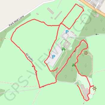
Interactive trail map

Trail profile

  • Distance: 1.4 mi
  • Elevation gain: 151 ft
  • Maximum elevation: 285 ft
  • Elevation loss: 174 ft
  • Minimum elevation: 184 ft
  • Moving time: 53 m 51 s
  • Moving speed: 1.6 mph
  • Maximum speed: 2.8 mph
  • Total time: 1 h 16 m
  • Global speed: 1.1 mph

About this trail

Gear up for your next adventure:

🎒Trekking Poles - Sturdy poles for balance and stability on rough terrain
🦟Ultrasonic Repellers - Create a bug-free zone at your camp or rest stop
🕶️GPS Smartphone Mount - Secure mount for phone navigation
🧭GPS Watch Accessories - Bands and chargers for GPS watches
📌Outdoor GPS Map App - Apps and devices for digital topographic navigation

As an Amazon Associate, this site earns from qualifying purchases at no extra cost to you.