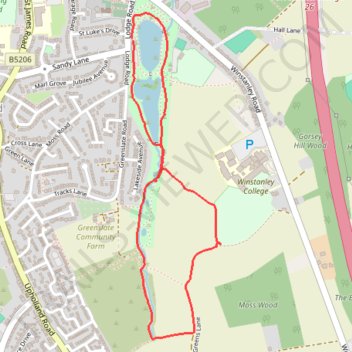
Orrell Water Park Loop Walk
- Distance: 1.9 mi
- Elevation gain: 89 ft
- Maximum elevation: 374 ft
- Elevation loss: 89 ft
- Minimum elevation: 302 ft
- Moving time: 49 m 10 s
- Moving speed: 2.3 mph
- Maximum speed: 3.3 mph
- Total time: 1 h 3 m
- Global speed: 1.8 mph
Interactive trail map
Trail profile
- Distance: 1.9 mi
- Elevation gain: 89 ft
- Maximum elevation: 374 ft
- Elevation loss: 89 ft
- Minimum elevation: 302 ft
- Moving time: 49 m 10 s
- Moving speed: 2.3 mph
- Maximum speed: 3.3 mph
- Total time: 1 h 3 m
- Global speed: 1.8 mph
About this trail
Name: Orrell Water Park Loop Walk trail, distance, elevation, map, profile, GPS track
Coordinates: 53.51819 -2.70855 53.52896 -2.70358