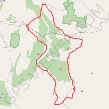
Cookamidgera - House of Commons Mountain loop
- Distance: 39.9 mi
- Elevation gain: 2,306 ft
- Maximum elevation: 1,745 ft
- Elevation loss: 2,306 ft
- Minimum elevation: 984 ft
- Moving time: 3 h 26 m
- Moving speed: 11.6 mph
- Maximum speed: 21.1 mph
- Total time: 3 h 26 m
- Global speed: 11.6 mph
Interactive trail map
Trail profile
- Distance: 39.9 mi
- Elevation gain: 2,306 ft
- Maximum elevation: 1,745 ft
- Elevation loss: 2,306 ft
- Minimum elevation: 984 ft
- Moving time: 3 h 26 m
- Moving speed: 11.6 mph
- Maximum speed: 21.1 mph
- Total time: 3 h 26 m
- Global speed: 11.6 mph
About this trail
Name: Cookamidgera - House of Commons Mountain loop trail, distance, elevation, map, profile, GPS track
Coordinates: -33.35857 148.30051 -33.16009 148.43247
Other hiking, mountain biking, running and outdoor activity trails
Click on a trail to view its statistics, map and profile.
Eugowra - House of Commons Mountain loop
Australia > New South Wales > Eugowra
Distance: 40.7 mi • Elevation gain: 2,474 ft • Maximum elevation: 1,719 ft