Make a donation
Gear up for your next adventure:
As an Amazon Associate, this site earns from qualifying purchases at no extra cost to you.
Mount Ramon and Mount Ido
הר רמון והר עידו מעלה: הפריזמות ומעלה ערוד באזור הכי על-הירח שיש
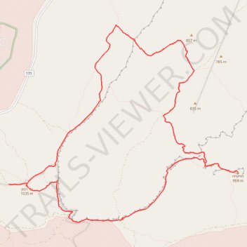
- Distance: 12.2 mi
- Elevation gain: 2,188 ft
- Maximum elevation: 3,379 ft
- Elevation loss: 2,188 ft
- Minimum elevation: 2,418 ft
- Moving time: 5 h 44 m
- Moving speed: 2.1 mph
- Maximum speed: 2.5 mph
- Total time: 5 h 44 m
- Global speed: 2.1 mph
Interactive trail map
Make a donation
Gear up for your next adventure:
As an Amazon Associate, this site earns from qualifying purchases at no extra cost to you.
Trail profile
- Distance: 12.2 mi
- Elevation gain: 2,188 ft
- Maximum elevation: 3,379 ft
- Elevation loss: 2,188 ft
- Minimum elevation: 2,418 ft
- Moving time: 5 h 44 m
- Moving speed: 2.1 mph
- Maximum speed: 2.5 mph
- Total time: 5 h 44 m
- Global speed: 2.1 mph
Make a donation
Gear up for your next adventure:
As an Amazon Associate, this site earns from qualifying purchases at no extra cost to you.
About this trail
Name: Mount Ramon and Mount Ido trail, distance, elevation, map, profile, GPS track
Coordinates: 30.49470 34.63170 30.53459 34.68534
Make a donation
Gear up for your next adventure:
As an Amazon Associate, this site earns from qualifying purchases at no extra cost to you.
Other hiking, mountain biking, running and outdoor activity trails
Click on a trail to view its statistics, map and profile.
Mount Ramon - Mount Arif
Israel > South District > Ramat Negev Regional Council
הר רמון להר עריף: הכי רחוק מציוויליזציה וארוך מספיק לזקק
Distance: 26.7 mi • Elevation gain: 3,802 ft • Maximum elevation: 3,379 ft
Ramon and Lotz
Israel > South District > Ramat Negev Regional Council
הר רמון ולוץ: בורות לוץ ומעלה לוץ
Distance: 16.6 mi • Elevation gain: 1,896 ft • Maximum elevation: 3,379 ft