Secret path
- Distance: 5.8 mi
- Elevation gain: 594 ft
- Maximum elevation: 1,493 ft
- Elevation loss: 1,929 ft
- Minimum elevation: 154 ft
Interactive trail map
Trail profile
- Distance: 5.8 mi
- Elevation gain: 594 ft
- Maximum elevation: 1,493 ft
- Elevation loss: 1,929 ft
- Minimum elevation: 154 ft
About this trail
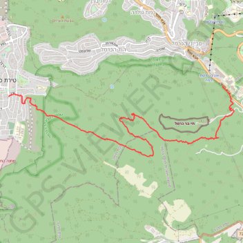
Name: Secret path trail, distance, elevation, map, profile, GPS track
Coordinates: 32.74742 34.97298 32.76017 35.02185
Other hiking, mountain biking, running and outdoor activity trails
Click on a trail to view its statistics, map and profile.
Home78Rec
Israel > Haifa District > Nesher
Distance: 48.7 mi • Elevation gain: 4,852 ft • Maximum elevation: 1,512 ft