Make a donation
Gear up for your next adventure:
As an Amazon Associate, this site earns from qualifying purchases at no extra cost to you.
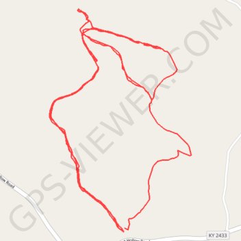
Jesse Stuart Nature Preserve
Load Hike
- Distance: 4.1 mi
- Elevation gain: 453 ft
- Maximum elevation: 889 ft
- Elevation loss: 453 ft
- Minimum elevation: 738 ft
- Moving time: 2 h 48 m
- Moving speed: 1.5 mph
- Maximum speed: 18.0 mph
- Total time: 5 h 22 m
- Global speed: 0.8 mph
Interactive trail map
Make a donation
Gear up for your next adventure:
As an Amazon Associate, this site earns from qualifying purchases at no extra cost to you.
Trail profile
- Distance: 4.1 mi
- Elevation gain: 453 ft
- Maximum elevation: 889 ft
- Elevation loss: 453 ft
- Minimum elevation: 738 ft
- Moving time: 2 h 48 m
- Moving speed: 1.5 mph
- Maximum speed: 18.0 mph
- Total time: 5 h 22 m
- Global speed: 0.8 mph
Make a donation
Gear up for your next adventure:
As an Amazon Associate, this site earns from qualifying purchases at no extra cost to you.
About this trail
Name: Jesse Stuart Nature Preserve trail, distance, elevation, map, profile, GPS track
Start: Shingle Mill Hollow Loop Trail, Greenup County, Kentucky, 41144, United States (38.54719 -82.84160)
End: Shingle Mill Hollow Loop Trail, Greenup County, Kentucky, 41144, United States (38.54734 -82.84155)
Coordinates: 38.54719 -82.84517 38.55562 -82.83833
Topography: Greenup County topographic map, elevation, terrain
Make a donation
Gear up for your next adventure:
As an Amazon Associate, this site earns from qualifying purchases at no extra cost to you.