
Summerhill MTB Trails
- Distance: 7.3 mi
- Elevation gain: 1,391 ft
- Maximum elevation: 673 ft
- Elevation loss: 1,394 ft
- Minimum elevation: 269 ft
- Moving time: 1 h 8 m
- Moving speed: 6.4 mph
- Maximum speed: 25.4 mph
- Total time: 1 h 21 m
- Global speed: 5.4 mph
Interactive trail map
Trail profile
- Distance: 7.3 mi
- Elevation gain: 1,391 ft
- Maximum elevation: 673 ft
- Elevation loss: 1,394 ft
- Minimum elevation: 269 ft
- Moving time: 1 h 8 m
- Moving speed: 6.4 mph
- Maximum speed: 25.4 mph
- Total time: 1 h 21 m
- Global speed: 5.4 mph
About this trail
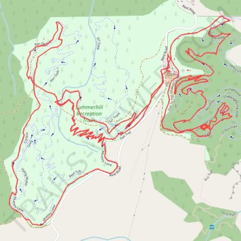
Name: Summerhill MTB Trails trail, distance, elevation, map, profile, GPS track
Start: Reid Road, Western Bay of Plenty District, Bay of Plenty, 3187, New Zealand (-37.74066 176.27004)
Coordinates: -37.74794 176.26066 -37.73811 176.27391