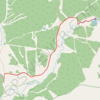
Thank you for supporting this site ❤️
Make a donation
Make a donation
Gear up for your next adventure:
As an Amazon Associate, this site earns from qualifying purchases at no extra cost to you.
McCann Bothy
- Distance: 1.6 mi
- Elevation gain: 36 ft
- Maximum elevation: 535 ft
- Elevation loss: 394 ft
- Minimum elevation: 174 ft
- Moving time: 28 m 28 s
- Moving speed: 3.4 mph
- Maximum speed: 4.6 mph
- Total time: 28 m 28 s
- Global speed: 3.4 mph
Interactive trail map
Thank you for supporting this site ❤️
Make a donation
Make a donation
Gear up for your next adventure:
As an Amazon Associate, this site earns from qualifying purchases at no extra cost to you.
Trail profile
- Distance: 1.6 mi
- Elevation gain: 36 ft
- Maximum elevation: 535 ft
- Elevation loss: 394 ft
- Minimum elevation: 174 ft
- Moving time: 28 m 28 s
- Moving speed: 3.4 mph
- Maximum speed: 4.6 mph
- Total time: 28 m 28 s
- Global speed: 3.4 mph
Thank you for supporting this site ❤️
Make a donation
Make a donation
Gear up for your next adventure:
As an Amazon Associate, this site earns from qualifying purchases at no extra cost to you.
About this trail
Name: McCann Bothy trail, distance, elevation, map, profile, GPS track
Coordinates: 53.98502 -9.56090 53.99523 -9.53630
Thank you for supporting this site ❤️
Make a donation
Make a donation
Gear up for your next adventure:
As an Amazon Associate, this site earns from qualifying purchases at no extra cost to you.