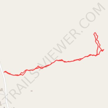
Thank you for supporting this site ❤️
Make a donation
Make a donation
Gear up for your next adventure:
As an Amazon Associate, this site earns from qualifying purchases at no extra cost to you.
Cnoc Leitir Móir
- Distance: 0.9 mi
- Elevation gain: 299 ft
- Maximum elevation: 371 ft
- Elevation loss: 302 ft
- Minimum elevation: 85 ft
- Moving time: 28 m 29 s
- Moving speed: 1.9 mph
- Maximum speed: 5.2 mph
- Total time: 32 m 57 s
- Global speed: 1.6 mph
Interactive trail map
Thank you for supporting this site ❤️
Make a donation
Make a donation
Gear up for your next adventure:
As an Amazon Associate, this site earns from qualifying purchases at no extra cost to you.
Trail profile
- Distance: 0.9 mi
- Elevation gain: 299 ft
- Maximum elevation: 371 ft
- Elevation loss: 302 ft
- Minimum elevation: 85 ft
- Moving time: 28 m 29 s
- Moving speed: 1.9 mph
- Maximum speed: 5.2 mph
- Total time: 32 m 57 s
- Global speed: 1.6 mph
Thank you for supporting this site ❤️
Make a donation
Make a donation
Gear up for your next adventure:
As an Amazon Associate, this site earns from qualifying purchases at no extra cost to you.
About this trail
Name: Cnoc Leitir Móir trail, distance, elevation, map, profile, GPS track
Coordinates: 53.29497 -9.67118 53.29701 -9.66325
Thank you for supporting this site ❤️
Make a donation
Make a donation
Gear up for your next adventure:
As an Amazon Associate, this site earns from qualifying purchases at no extra cost to you.