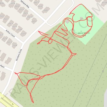
Thank you for supporting this site ❤️
Make a donation
Make a donation
Gear up for your next adventure:
As an Amazon Associate, this site earns from qualifying purchases at no extra cost to you.
David March Park
- Distance: 1.1 mi
- Elevation gain: 112 ft
- Maximum elevation: 1,526 ft
- Elevation loss: 112 ft
- Minimum elevation: 1,447 ft
- Moving time: 27 m 17 s
- Moving speed: 2.4 mph
- Maximum speed: 4.0 mph
- Total time: 31 m 4 s
- Global speed: 2.1 mph
Interactive trail map
Thank you for supporting this site ❤️
Make a donation
Make a donation
Gear up for your next adventure:
As an Amazon Associate, this site earns from qualifying purchases at no extra cost to you.
Trail profile
- Distance: 1.1 mi
- Elevation gain: 112 ft
- Maximum elevation: 1,526 ft
- Elevation loss: 112 ft
- Minimum elevation: 1,447 ft
- Moving time: 27 m 17 s
- Moving speed: 2.4 mph
- Maximum speed: 4.0 mph
- Total time: 31 m 4 s
- Global speed: 2.1 mph
Thank you for supporting this site ❤️
Make a donation
Make a donation
Gear up for your next adventure:
As an Amazon Associate, this site earns from qualifying purchases at no extra cost to you.
About this trail
Name: David March Park trail, distance, elevation, map, profile, GPS track
Coordinates: 34.44743 -118.48963 34.45002 -118.48717
Topography: Santa Clarita topographic map, elevation, terrain
Thank you for supporting this site ❤️
Make a donation
Make a donation
Gear up for your next adventure:
As an Amazon Associate, this site earns from qualifying purchases at no extra cost to you.