Ellicott City - David W Force Park
- Distance: 3.0 mi
- Elevation gain: 141 ft
- Maximum elevation: 453 ft
- Elevation loss: 138 ft
- Minimum elevation: 361 ft
- Moving time: 59 m 42 s
- Moving speed: 3.0 mph
- Maximum speed: 6.6 mph
- Total time: 1 h 1 m
- Global speed: 2.9 mph
Interactive trail map
Trail profile
- Distance: 3.0 mi
- Elevation gain: 141 ft
- Maximum elevation: 453 ft
- Elevation loss: 138 ft
- Minimum elevation: 361 ft
- Moving time: 59 m 42 s
- Moving speed: 3.0 mph
- Maximum speed: 6.6 mph
- Total time: 1 h 1 m
- Global speed: 2.9 mph
About this trail
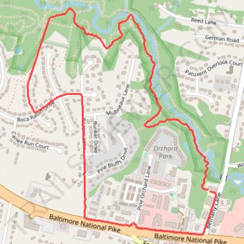
Name: Ellicott City - David W Force Park trail, distance, elevation, map, profile, GPS track
Coordinates: 39.27962 -76.87166 39.29099 -76.85938
Topography: Howard County topographic map, elevation, terrain