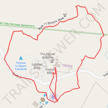
Walk 11 Botanic Walk
- Distance: 1.0 mi
- Elevation gain: 20 ft
- Maximum elevation: 203 ft
- Elevation loss: 20 ft
- Minimum elevation: 184 ft
- Moving time: 33 m 21 s
- Moving speed: 1.8 mph
- Maximum speed: 3.5 mph
- Total time: 2 h 4 m
- Global speed: 0.5 mph
Interactive trail map
Trail profile
- Distance: 1.0 mi
- Elevation gain: 20 ft
- Maximum elevation: 203 ft
- Elevation loss: 20 ft
- Minimum elevation: 184 ft
- Moving time: 33 m 21 s
- Moving speed: 1.8 mph
- Maximum speed: 3.5 mph
- Total time: 2 h 4 m
- Global speed: 0.5 mph
About this trail
Name: Walk 11 Botanic Walk trail, distance, elevation, map, profile, GPS track
Coordinates: -33.76291 140.12250 -33.75959 140.12661