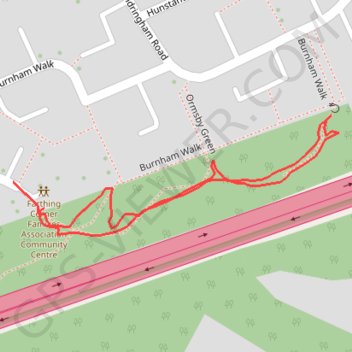
Thank you for supporting this site ❤️
Make a donation
Make a donation
Gear up for your next adventure:
As an Amazon Associate, this site earns from qualifying purchases at no extra cost to you.
Upper Brooms Wood
Wood map
- Distance: 0.5 mi
- Elevation gain: 36 ft
- Maximum elevation: 413 ft
- Elevation loss: 30 ft
- Minimum elevation: 381 ft
- Moving time: 11 m 29 s
- Moving speed: 2.5 mph
- Maximum speed: 4.3 mph
- Total time: 11 m 29 s
- Global speed: 2.5 mph
Interactive trail map
Thank you for supporting this site ❤️
Make a donation
Make a donation
Gear up for your next adventure:
As an Amazon Associate, this site earns from qualifying purchases at no extra cost to you.
Trail profile
- Distance: 0.5 mi
- Elevation gain: 36 ft
- Maximum elevation: 413 ft
- Elevation loss: 30 ft
- Minimum elevation: 381 ft
- Moving time: 11 m 29 s
- Moving speed: 2.5 mph
- Maximum speed: 4.3 mph
- Total time: 11 m 29 s
- Global speed: 2.5 mph
Thank you for supporting this site ❤️
Make a donation
Make a donation
Gear up for your next adventure:
As an Amazon Associate, this site earns from qualifying purchases at no extra cost to you.
About this trail
Name: Upper Brooms Wood trail, distance, elevation, map, profile, GPS track
Coordinates: 51.33976 0.59812 51.34070 0.60221
Thank you for supporting this site ❤️
Make a donation
Make a donation
Gear up for your next adventure:
As an Amazon Associate, this site earns from qualifying purchases at no extra cost to you.