Munro hillwalk 12 summits loop
A'Chailleach, Toman Còinnich, Sgùrr Breac, Sgùrr nan Each, Sgùrr nan Clach Geala, Meall a' Chrasgaidh, Carn na Criche, Sgùrr Mòr, Beinn Liath Mhor Fannaich, Meall nam Peithirean, Meall Gorm, An Coileachan.
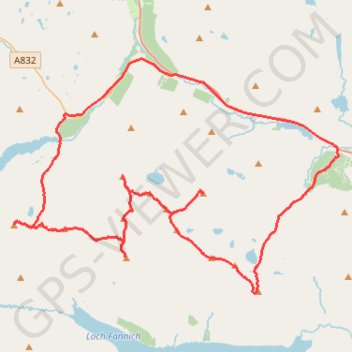
- Distance: 33.6 mi
- Elevation gain: 9,278 ft
- Maximum elevation: 3,619 ft
- Elevation loss: 9,278 ft
- Minimum elevation: 581 ft
- Moving time: 15 h 26 m
- Moving speed: 2.2 mph
- Maximum speed: 22.9 mph
- Total time: 1 d 3 h
- Global speed: 1.2 mph
Interactive trail map
Trail profile
- Distance: 33.6 mi
- Elevation gain: 9,278 ft
- Maximum elevation: 3,619 ft
- Elevation loss: 9,278 ft
- Minimum elevation: 581 ft
- Moving time: 15 h 26 m
- Moving speed: 2.2 mph
- Maximum speed: 22.9 mph
- Total time: 1 d 3 h
- Global speed: 1.2 mph
About this trail
Name: Munro hillwalk 12 summits loop trail, distance, elevation, map, profile, GPS track
Start: A832, Highland, Scotland, United Kingdom (57.73740 -5.09025)
End: A832, Highland, Scotland, United Kingdom (57.73740 -5.09021)
Coordinates: 57.66676 -5.12879 57.75897 -4.88986