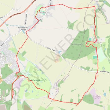
Circular walk through Muxton and Lilleshall
- Distance: 9.3 mi
- Elevation gain: 633 ft
- Maximum elevation: 518 ft
- Elevation loss: 633 ft
- Minimum elevation: 246 ft
- Moving time: 3 h 36 m
- Moving speed: 2.6 mph
- Maximum speed: 4.1 mph
- Total time: 4 h 54 m
- Global speed: 1.9 mph
Interactive trail map
Trail profile
- Distance: 9.3 mi
- Elevation gain: 633 ft
- Maximum elevation: 518 ft
- Elevation loss: 633 ft
- Minimum elevation: 246 ft
- Moving time: 3 h 36 m
- Moving speed: 2.6 mph
- Maximum speed: 4.1 mph
- Total time: 4 h 54 m
- Global speed: 1.9 mph
About this trail
Name: Circular walk through Muxton and Lilleshall trail, distance, elevation, map, profile, GPS track
Coordinates: 52.70709 -2.41722 52.73949 -2.37185