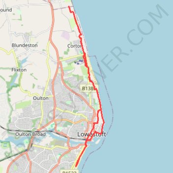
Suffolk Coast Path (SCP) between Hopton and Lowestoft
- Distance: 12.3 mi
- Elevation gain: 456 ft
- Maximum elevation: 98 ft
- Elevation loss: 456 ft
- Minimum elevation: -10 ft
- Moving time: 4 h 25 m
- Moving speed: 2.8 mph
- Maximum speed: 7.0 mph
- Total time: 5 h 22 m
- Global speed: 2.3 mph
Interactive trail map
Trail profile
- Distance: 12.3 mi
- Elevation gain: 456 ft
- Maximum elevation: 98 ft
- Elevation loss: 456 ft
- Minimum elevation: -10 ft
- Moving time: 4 h 25 m
- Moving speed: 2.8 mph
- Maximum speed: 7.0 mph
- Total time: 5 h 22 m
- Global speed: 2.3 mph
About this trail
Name: Suffolk Coast Path (SCP) between Hopton and Lowestoft trail, distance, elevation, map, profile, GPS track
Start: Coast Road, Corton, East Suffolk, Suffolk, England, NR32 5JD, United Kingdom (52.51560 1.74682)
End: The Street, Corton, East Suffolk, Suffolk, England, NR32 5HT, United Kingdom (52.51546 1.74694)
Coordinates: 52.46248 1.73777 52.53187 1.76287