Gravel ride around Prospect Hill
- Distance: 14.5 mi
- Elevation gain: 1,004 ft
- Maximum elevation: 266 ft
- Elevation loss: 1,004 ft
- Minimum elevation: 26 ft
- Moving time: 1 h 26 m
- Moving speed: 10.1 mph
- Maximum speed: 34.6 mph
- Total time: 1 h 34 m
- Global speed: 9.2 mph
Interactive trail map
Trail profile
- Distance: 14.5 mi
- Elevation gain: 1,004 ft
- Maximum elevation: 266 ft
- Elevation loss: 1,004 ft
- Minimum elevation: 26 ft
- Moving time: 1 h 26 m
- Moving speed: 10.1 mph
- Maximum speed: 34.6 mph
- Total time: 1 h 34 m
- Global speed: 9.2 mph
About this trail
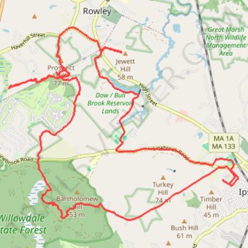
Name: Gravel ride around Prospect Hill trail, distance, elevation, map, profile, GPS track
Coordinates: 42.67385 -70.90450 42.71046 -70.84517
Topography: Essex County topographic map, elevation, terrain