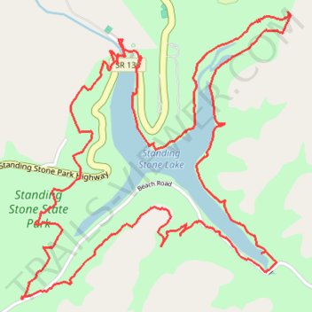
Standing Stone State Park - Lake Trail loop hike
- Distance: 5.2 mi
- Elevation gain: 994 ft
- Maximum elevation: 958 ft
- Elevation loss: 994 ft
- Minimum elevation: 692 ft
- Moving time: 2 h 34 m
- Moving speed: 2.0 mph
- Maximum speed: 10.0 mph
- Total time: 3 h 20 m
- Global speed: 1.6 mph
Interactive trail map
Trail profile
- Distance: 5.2 mi
- Elevation gain: 994 ft
- Maximum elevation: 958 ft
- Elevation loss: 994 ft
- Minimum elevation: 692 ft
- Moving time: 2 h 34 m
- Moving speed: 2.0 mph
- Maximum speed: 10.0 mph
- Total time: 3 h 20 m
- Global speed: 1.6 mph
About this trail
Name: Standing Stone State Park - Lake Trail loop hike trail, distance, elevation, map, profile, GPS track
Coordinates: 36.46047 -85.42370 36.47291 -85.40923
Topography: Overton County topographic map, elevation, terrain