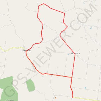
Leafdale to Stonelands
Leafdale, Mondure, Marshlands, Wooroonden, Stonelenda, Hivesville, Keysland, Queensland
- Distance: 28.0 mi
- Elevation gain: 1,161 ft
- Maximum elevation: 1,424 ft
- Elevation loss: 1,161 ft
- Minimum elevation: 846 ft
- Moving time: 2 h 27 m
- Moving speed: 11.4 mph
- Maximum speed: 30.2 mph
- Total time: 3 h 6 m
- Global speed: 9.0 mph
Interactive trail map
Trail profile
- Distance: 28.0 mi
- Elevation gain: 1,161 ft
- Maximum elevation: 1,424 ft
- Elevation loss: 1,161 ft
- Minimum elevation: 846 ft
- Moving time: 2 h 27 m
- Moving speed: 11.4 mph
- Maximum speed: 30.2 mph
- Total time: 3 h 6 m
- Global speed: 9.0 mph
About this trail
Name: Leafdale to Stonelands trail, distance, elevation, map, profile, GPS track
Start: Mount McEuen Road, Leafdale, South Burnett Regional, Queensland, Australia (-26.24797 151.77129)
End: Mount McEuen Road, Leafdale, South Burnett Regional, Queensland, Australia (-26.24795 151.77127)
Coordinates: -26.24800 151.69127 -26.10487 151.77539
Other hiking, mountain biking, running and outdoor activity trails
Click on a trail to view its statistics, map and profile.
Ficks Crossing to Hivesville
Australia > Queensland > Wheatlands
Ficks Crossing, Wheatlands, Silverleaf, Marshlands, Hivesville, Leafdale, Keysland, Chelmsford, Queensland
Distance: 34.0 mi • Elevation gain: 1,296 ft • Maximum elevation: 1,421 ft
Ficks Crossing to Mount McEuen Queensland
Australia > Queensland > Ficks Crossing
Ficks Crossing, Wheatlands, Vhelmsford, Leafdale, Keysland, Mt McEuen, Fairdale, Queensland
Distance: 28.8 mi • Elevation gain: 1,316 ft • Maximum elevation: 1,368 ft
Byee to Greenview, Cushnie and Mondure
Australia > Queensland > Byee
Distance: 34.3 mi • Elevation gain: 1,250 ft • Maximum elevation: 1,539 ft
Wheatlands to Wooroonden
Australia > Queensland > Wheatlands
Wheatlands, Byee, Silverleaf, Wooroonden, Marshlands, Mondure, Queensland
Distance: 26.5 mi • Elevation gain: 591 ft • Maximum elevation: 1,010 ft
Mondure to Windera Park
Mondure, Silverleaf, Warnung, Cloyna, Kitoba, Windera, Glenrock
Distance: 34.6 mi • Elevation gain: 1,063 ft • Maximum elevation: 1,007 ft