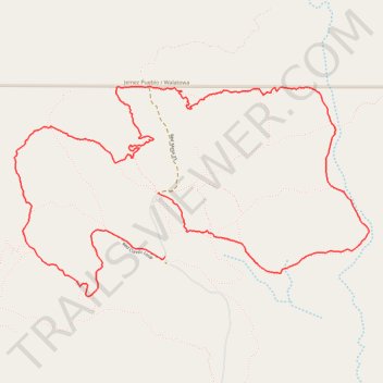
Red Classic Loop
- Distance: 5.9 mi
- Elevation gain: 597 ft
- Maximum elevation: 5,814 ft
- Elevation loss: 607 ft
- Minimum elevation: 5,541 ft
Interactive trail map
Trail profile
- Distance: 5.9 mi
- Elevation gain: 597 ft
- Maximum elevation: 5,814 ft
- Elevation loss: 607 ft
- Minimum elevation: 5,541 ft
About this trail
Name: Red Classic Loop trail, distance, elevation, map, profile, GPS track
Start: Red Classic Loop, Sandoval County, New Mexico, 87053, United States (35.56450 -106.81275)
End: Red Mesa 33, Sandoval County, New Mexico, 87053, United States (35.56853 -106.81325)
Coordinates: 35.56198 -106.82437 35.57518 -106.79704
Topography: Sandoval County topographic map, elevation, terrain