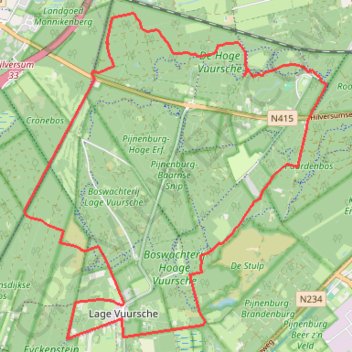
Route_02-02-2023_18-56-37
- Distance: 10.0 mi
- Elevation gain: 131 ft
- Maximum elevation: 36 ft
- Elevation loss: 131 ft
- Minimum elevation: 10 ft
Interactive trail map
Trail profile
- Distance: 10.0 mi
- Elevation gain: 131 ft
- Maximum elevation: 36 ft
- Elevation loss: 131 ft
- Minimum elevation: 10 ft
About this trail
Name: Route_02-02-2023_18-56-37 trail, distance, elevation, map, profile, GPS track
Start: H. Voorveldlaan, Baarn, Utrecht, Netherlands, 3744 KD, Netherlands (52.20712 5.25776)
End: Bosbadlaan, Baarn, Utrecht, Netherlands, 3744 KD, Netherlands (52.20702 5.25759)
Coordinates: 52.17634 5.20404 52.21381 5.26079