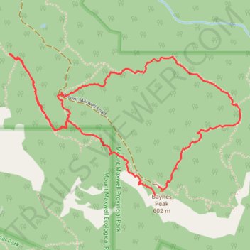
Mount Maxwell Provincial Park trails
- Distance: 2.7 mi
- Elevation gain: 879 ft
- Maximum elevation: 1,893 ft
- Elevation loss: 784 ft
- Minimum elevation: 1,549 ft
- Moving time: 1 h 17 m
- Moving speed: 2.1 mph
- Maximum speed: 3.6 mph
- Total time: 1 h 38 m
- Global speed: 1.6 mph
Interactive trail map
Trail profile
- Distance: 2.7 mi
- Elevation gain: 879 ft
- Maximum elevation: 1,893 ft
- Elevation loss: 784 ft
- Minimum elevation: 1,549 ft
- Moving time: 1 h 17 m
- Moving speed: 2.1 mph
- Maximum speed: 3.6 mph
- Total time: 1 h 38 m
- Global speed: 1.6 mph
About this trail
Name: Mount Maxwell Provincial Park trails trail, distance, elevation, map, profile, GPS track
Coordinates: 48.80137 -123.52772 48.80806 -123.51111
Other hiking, mountain biking, running and outdoor activity trails
Click on a trail to view its statistics, map and profile.
BBF loop to the Skydeck in Nanaimo
Canada > British Columbia > Cowichan Valley Regional District > Area A (Mill Bay / Malahat) > Mill Bay
BBF loop to the Skydeck
Distance: 201.0 mi • Elevation gain: 20,413 ft • Maximum elevation: 2,316 ft