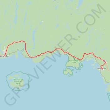
Terrace Bay - Marathon
Lake Superior. #Bike #TerraceBay #Marathon #LakeSuperior
- Distance: 51.6 mi
- Elevation gain: 3,547 ft
- Maximum elevation: 1,056 ft
- Elevation loss: 3,652 ft
- Minimum elevation: 607 ft
Interactive trail map
Trail profile
- Distance: 51.6 mi
- Elevation gain: 3,547 ft
- Maximum elevation: 1,056 ft
- Elevation loss: 3,652 ft
- Minimum elevation: 607 ft
About this trail
Name: Terrace Bay - Marathon trail, distance, elevation, map, profile, GPS track
Coordinates: 48.71648 -87.10240 48.85717 -86.33869
Other hiking, mountain biking, running and outdoor activity trails
Click on a trail to view its statistics, map and profile.
Marathon - White River
Canada > Ontario > Thunder Bay District > Marathon
Distance: 56.0 mi • Elevation gain: 2,464 ft • Maximum elevation: 1,335 ft